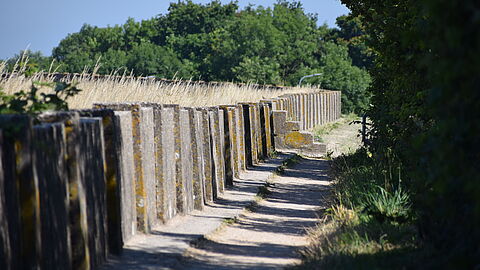
The long muralt wall on the old sea dike along the Grevelingen near Scharendijke, is impressive and designated as a national monument. This work of art starts west of Scharendijke, at "het Koepeltje" located just within the dunes. To the east of the marina, it continues towards Den Osse (Langendijk). On the landside lay the land reclamation areas (inlaag in Dutch) and cart fields dating back to the fifteenth and sixteenth century.
Beautiful view
Walk from the west over the dike to the marina, above the Inlaag, the Elkerzeese road, and the Baken. From the footpath strewn with fine gravel, you have a beautiful view of the Grevelingenmeer with the salt marsh island Hompelvoet. To the northwest, the sea no longer surges with gray foaming crowns. Instead, , the safe Brouwersdam lies there. There, on the horizon, the Mediterranean-style facades of the holidayvillage Port Zélande rise, with the Kabbelaarsbank. On the landside, you can look over the roofs of the modest village houses of Scharendijke.
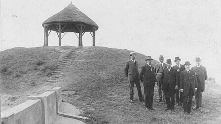
Jonkheer De Muralt
Muralt walls are invented by Esquire (Jonkheer in Dutch) ir. Robert Rudolph Lodewijk de Muralt. De Muralt started his career in the Dutch East Indies as an engineer for the Public Works Department. He later came to Schouwen-Duiveland. From 1903 to 1913, he was the head of the Technical Department of the water board. De Muralt had already developed a system of reinforced concrete sea revetments. These were much cheaper than the conventional basalt revetments. The concrete revetments withstood the storms of 1906 and 1911 with hardly any damage. For his efforts, De Muralt received the prestigious Conrad Prize, an international award.
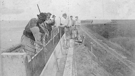
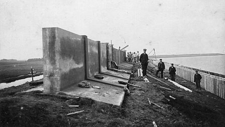
Alternative dike elevation
Just like after the storm surge of 1808, after the flood of 1906 they decided to do a general dike elevation. Once again, De Muralt came up with a cheap, concrete solution. He developed the muralt walls: an alternative dike elevation that did not require widening the dike itself. A tremendous saving. Between 1906 and 1935, approximately 120 kilometers of Zeeland's sea dikes were equipped with these walls. This accounted for about a quarter of all sea dikes in Zeeland in that period!
Disaster strikes
Unfortunately, the muralt walls did not prevent disaster. The Great Flood of 1953 demonstrated that devastatingly. Most "muralt walls" were removed during the dike reinforcements after 1953. However, the walls remained on dikes that no longer have a primary water-retaining function, like along the Veerse Meer near Wolphaartsdijk or along the Oosterscheldedijk near the Plompe Toren.
To the east of Scharendijke, a blue monument sign from Waterschap Zeeuwse Eilanden is screwed onto the muralt wall. It appears small and insignificant on the elongated muralt wall. The sign also bears a flood mark from the Great Flood of 1953.
Source: Zeeuwse Ankers, Muralt wall near Scharendijke